Interactive Map
This an interactive map application that you can use to explore the Carnegie Libraries of Britain.
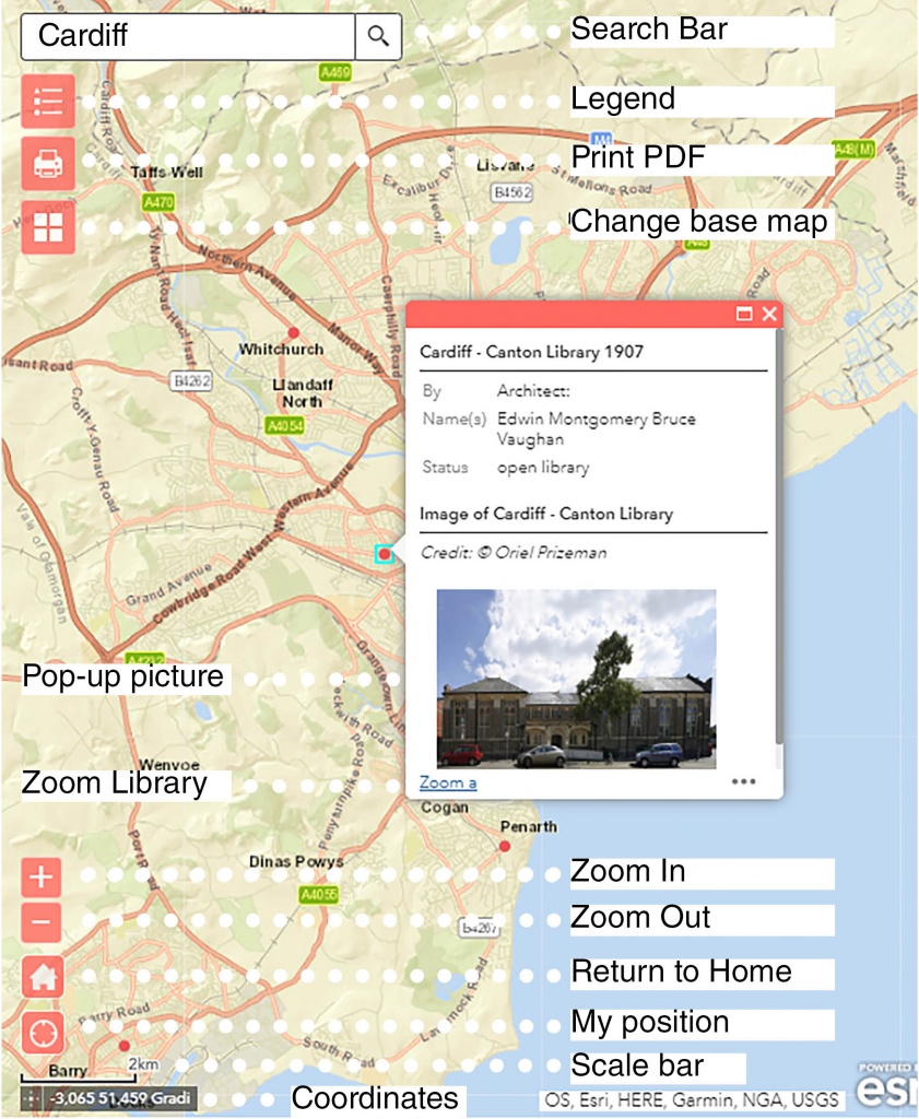
Navigation Instructions: To navigate the map, simply zoom in and out using two fingers, pressing on the + and – signs in the bottom left corner, or scrolling the wheel of your mouse. You can also use the search bar to input the name/postcode/address of the location you want to check and the App will zoom there. If you want to go back to the original Map just click on the home icon. If your GPS is active you can centre the map in your location using the ‘My position’ widget.
App functionalities and widgets
This interactive App has several functionalities and widgets. For a more complete overview look at the image and instructions below.

The libraries are marked with coloured dots, which correspond to different types of buildings as indicated in the legend under the search bar. To access a library’s information just click on a dot and a pop-up window will open. Among other information you can find an image of an existing building or an image from a historic map showing where the building used to stand. If you want to see it in full size, just click on the image and it will open in another window. To zoom the map to a library just click on the Zoom a link below the image.
When you hover your mouse/finger over a location its coordinates will appear in the bottom left corner, just under the scale bar. Other functionalities include base-map personalisation and map extract printing.
To personalise the map background, click on the corresponding widget and choose from the 24 thematic maps available: each one will evidence different aspects of the territory in which the libraries are inserted.
When clicking on the print widget, the App prompts you to input the printed map title, the paper size and the image format (e.g., PDF, but also JPG, GIF, etc.).
Important: all the images need to be credited as explained below!
| The printed coloured GIS map is free for you to use under a Creative Commons BY-NC-SA 4.0 license and must be credited as © Cardiff University “Shelf Life” AHRC project [grant number AH/P002587/1]. |  |
| All photographs are © Oriel Prizeman “Shelf Life” AHRC project [grant number AH/P002587/1]. |  |
| The historic map images for identifying the location of lost buildings in the pop-ups are Ordnance Survey copyrighted and must not be reproduced | NOT FOR RE-USE |
